
Knocknagorraveela [Cnoc na gCorrmhiolta]
Good walks are even better shared.
Overview
Knocknagorraveela [Cnoc na gCorrmhiolta]
Introduction
Nestled in the Caha Mountains of County Kerry, Knocknagorraveela stands as a quiet sentinel over its surroundings. At an elevation of 556 meters, it's not the highest mountain in the area, but it offers a decent challenge for hikers and some of the most splendid views.
Geology
Composed primarily of schist and quartzite, the geology of Knocknagorraveela unveils a complex history of ancient tectonics. The rocks beneath your feet date back millions of years and offer a narrative that geologists would be thrilled to delve into.
Route Information
One of the most favoured routes is the Cahir and Knocknagorraveela loop. This 8.5 km trek can be completed in around 3.5 hours, making it suitable for those who are moderately fit. Expect varied terrain, from grassy slopes to rocky outcrops and the occasional bog. Remember, though: boggy = squishy, so watch your step!
Summit Features
The summit boasts a modest cairn and offers ample flat ground to spread out a picnic. Just don’t invite a swarm of seagulls; they tend to steal lunch!
Terrain and Views
Hikers will enjoy a variety of terrains with plenty of opportunities for spectacular photography. The summit provides stunning views of the Caha Mountains, Lough Leane, and, if you’re lucky, a glimpse of the Atlantic Coast on a clear day. Optimal seasons for these views are spring and autumn when the air is crisp.
Hazards
While the adventure is rewarding, hikers should be mindful of the sharp turns in weather. It’s a good idea to bring layers and sturdy footwear to tackle the rocky bits. Staying hydrated is key, especially if you’re giving it a good go!
Nearby Summits
Don't forget to check out nearby peaks like Knocknagree at 604 metres and Seefin Mountain at 670 metres. A bit of summit hopping never hurt anyone!
Access & Facilities
Cahir offers ample facilities, including cafés and shops for a pre- or post-hike snack (we all love a good slice of cake, don’t we?). Parking is available, and public transport links make it relatively easy to access logically.
Conclusion
A trip to Knocknagorraveela is a fine way to embrace the great outdoors and take in the marvellous scenery. So pack your bag, lace up your boots, and head out for an incredible experience in the heart of the Caha Mountains!
Remember: it may not be the most famous mountain, but sometimes the best things come in small packages!
Explore routes near Knocknagorraveela [Cnoc na gCorrmhiolta]
Public walks starting within 80 km of this hill. Nearby does not mean a route reaches the summit; check its map and access before setting out.
No public routes are currently listed within 80 km of Knocknagorraveela [Cnoc na gCorrmhiolta] on Walkmates. This does not mean there are no paths here. Explore the map and check local access information before planning a walk.
Route planning notes
These notes describe possible approaches, not verified navigable routes or permission to cross land. Check current paths, local access rules and conditions before setting out.
Cahir and Knocknagorraveela Loop
A scenic loop starting from the village of Cahir, providing breathtaking views as you ascend.
Make a day of it, together
Find someone to share the walk with, or organise a day out along a route you like.
Hill facts and local notes
Classifications
Elevation
507m
1,663 ft
Prominence
153m
Coordinates
51.8030, -9.6375
V871624
OS Map
85
At the Summit
The summit features a modest cairn, a great spot for a well-earned break and some awe-striking views.
Terrain & Geology
The mountain is predominantly composed of schist and quartzite, offering a unique blend of geological formations that tell a story of ancient tectonic activity.
Views & Scenery
Dazzling views of the surrounding Caha Mountains, Lough Leane, and beyond to the Atlantic Ocean on clear days.
History & Heritage
Name Origin
Cnoc na gCorrmhiolta translates to 'Hill of the Corrmhíolta,' which seems to suggest some strong historical or mythical connection.
Historical Significance
The area is rich in folklore and is considered sacred by local communities, with numerous myths pertaining to the mountains.
Getting There & Facilities
Check current local access restrictions, parking rules and transport timetables before travelling. These notes do not confirm public access to the summit.
Parking
Parking is available at the village of Cahir, with space for several cars and a short walk to the trailhead.
Public Transport
Buses run from nearby towns to Cahir, making it accessible via public transport.
Nearby Facilities
Cahir has several cafes, a convenience store, and public toilets to accommodate hikers before and after their adventures.
Safety Information
Known Hazards
- Be wary of sudden weather changes in the mountains; a sunny day can turn misty in no time. The rocky terrain requires good footwear.
General Safety Tips
- Check weather conditions before setting out
- Carry appropriate clothing and equipment
- Let someone know your planned route
- Take a map, compass, and GPS device
- Carry emergency supplies: food, water, first aid kit, torch
Hills
Some common questions about the hills answered
Are there group walks up Knocknagorraveela [Cnoc na gCorrmhiolta]?
Many walkers use Walkmates to join or organise walks with others. You can check for group walks around Knocknagorraveela [Cnoc na gCorrmhiolta] through the maps
Are there other walkers around Knocknagorraveela [Cnoc na gCorrmhiolta]?
Activity varies by location and time, but Walkmates lets you see whether others have shared walks or shown interest in this area. Find other people through the walking friends search walking friends for Knocknagorraveela [Cnoc na gCorrmhiolta] search or of course create your own walk for Knocknagorraveela [Cnoc na gCorrmhiolta]
Can I organise a walk to Knocknagorraveela [Cnoc na gCorrmhiolta]?
Yes. If there aren’t any walks listed already, you can create a walk and make it available for others to join.
If you're signed up to Walkmates, you can create a walk to Knocknagorraveela [Cnoc na gCorrmhiolta].
How do I find a walk up this hill?
There are often multiple ways to walk this hill, depending on experience and route preference. Walkmates helps you explore walks and routes that others have shared.
Can I suggest a new route up Knocknagorraveela [Cnoc na gCorrmhiolta]?
Yes. You can suggest or create routes to share with others. Walkmates focuses on the social side of walking, so routes are used to help people organise walks and explore areas together, rather than as detailed navigation tools or route libraries.
Other uses really appreciate knowledgeable walkers sharing their routes. Share your favourite route to Knocknagorraveela [Cnoc na gCorrmhiolta] here
The is an error or something incorrect about this hill. How do I let you know?
We always strive to keep the information on Walkmates as accurate as possible. If you find an error, please let us know through the contact form and we'll aim to correct it as quickly as possible
Community Discussion
Comments
Location
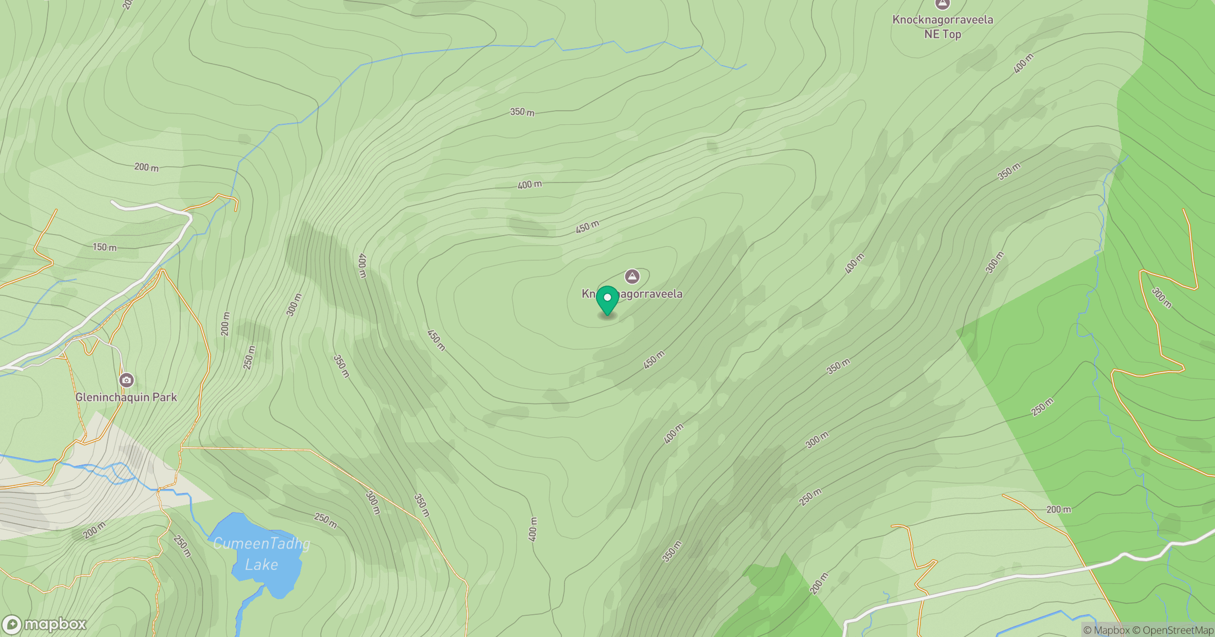
Grid reference: V871624
View on OpenStreetMapOpens a map in a new tab, centred on the hill.
Hills within 30 km
Straight-line distance, not a walking route or confirmation of access.
Carrauntoohil
1,039m
Torc Mountain
535m
Killaha Mountain [Sliabh Choill Atha]
405m
Sugarloaf Mountain [Gabhal Mhor]
574m
Shrone Hill
283m
No comments yet. Be the first.